Remote managed aircraft

For commercial and special tasks
AlterGeo Holding is the world's only company to have integrated a gyro-stabilized large-format photogrammetric camera system onto ultralight aircraft.

We stand out
from the competition.

Alter-Eye plane on the AlterGeo's airstrip
Ultralight and powerfull
The 600kg Light Sport Aircraft is a groundbreaking innovation in lightweight composite aircraft production, earning the title of "Polish Product of the Future" in 2004. This remarkable aircraft has won the Aerospace Expo SUN 'n FUN in Florida, USA, three times - in 2018, 2019, and 2021. Additionally, it claimed the top spot at the prestigious "Best of the Best" competition at the South African Air Fair, outperforming around 100 competing aircraft models from around the world.
Alter-Eye planes are remotely controlled via a satellite connection
Remotely controlled around the Globe via satellite connection.
The remote access to onboard computers enables a seamless data acquisition process from a ground station located in the office. This setup provides the pilot with robust support from the ground, allowing them to concentrate on precise flight and safety in compliance with international aviation regulations.
Outstanding carrying capacity
With an impressive payload capacity of over 60 kg, our system supports large-format sensors such as the PhaseOne 280 MP stabilized camera and long-range LiDAR scanners for simultaneous data acquisition. This capability vastly outperforms drones, enhancing acquisition efficiency by a factor of one hundred.
Alter-Eye planes have an impressive payload capacity of over 60 kg
We encourage you to contact us to learn about all our possibilities.

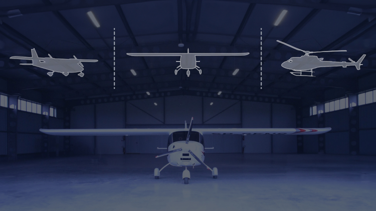
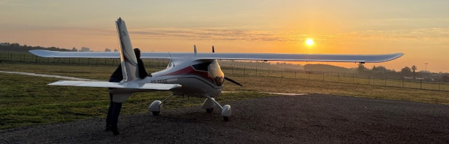
Alter-Eye performance

7
h
Max flying time
60
knots
Min operational velocity
500
ft AGL
Min operational altitude
1250
km
Max range
2000
sq. km daily
Performance
Alter-Eye plane has up to 100 better performance than a drone
Up to 100 better performance than drones
Extremely low cost of exploitation of ultralight aircraft and long range allowe reach remote destination without terrestrial roads. Fast data acquisition shorten time spending on mission.
Much cheaper than a helicopter and large plane
  • Low and slow flight gives similar results, especially in corridor mapping.
  • Short take-off and landing run (approx. 100 m) enlarge operational flexibility.
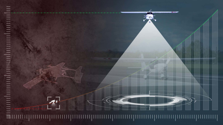
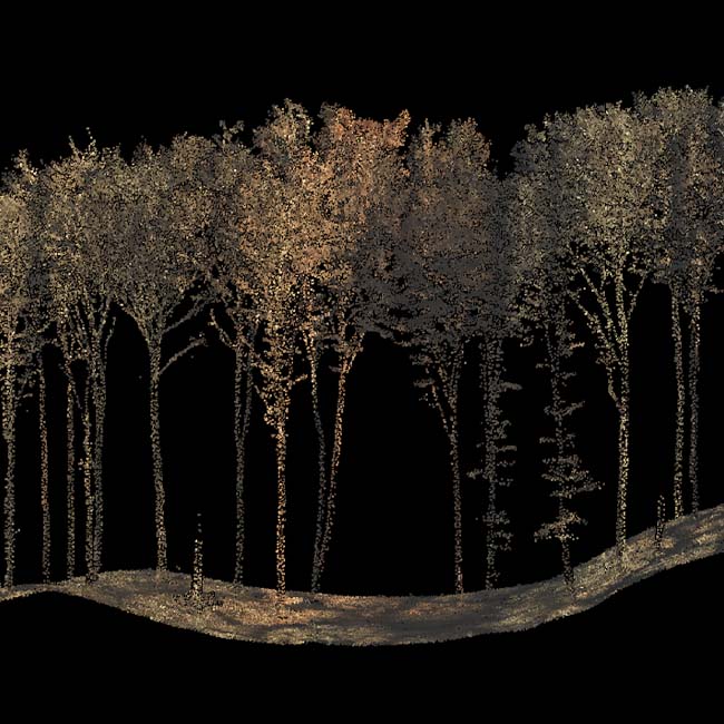
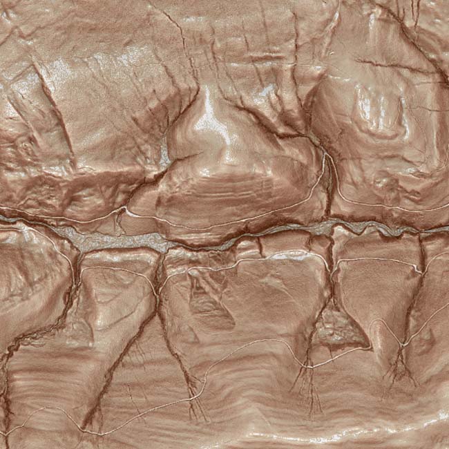
  • Low and slow flight gives extremely high resolution and high precision of observation unreachable from big airplane.
  • Costs of aircraft maintenance, service and exploitation are incomparable.
Alter-Eye plane is much cheaper than a helicopter and large plane
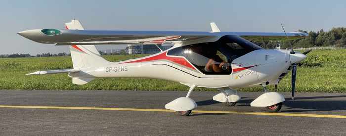
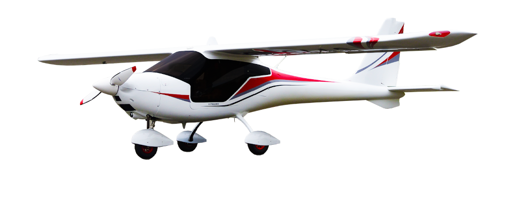
The Alter-Eye is a full composite custom carbon fibre designed high wing monoplane with remarkable individual features and performance. Want to know more? Contact us.
Alter-Eye plane

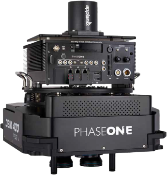
Integrations examples

The advantage of Alter-Eye compared to drones is high operability, resulting from the high take-off weight allowed by the regulations, which allowing the placeing off efficient devices and large fuel reserves on board - increasing the range and duration of air missions, even up to several hours.
Phase One PAS 280 with Somag Stabilizer
The Phase One PAS 280 MP large format camera on the Alter-Eye captures data at an impressive 1 cm GSD resolution. With a resolution range between 1 and 10 cm GSD, it provides the optimal precision required for accurate measurements across various industries.
CIR composition
CIR composition
CIR composition
CIR composition
Riegl VQ780i ALS
Riegl VQ780i ALS
The Long Range LIDAR scanner mounted on the Alter-Eye delivers dense measurements ranging from 200 to 2 points per square meter, depending on the flight altitude. Its field of view is synchronized with a photogrammetric RGB and NIR camera, enabling the simultaneous collection of both types of data during a single flight. This integration ensures perfectly correlated data for comprehensive future analysis.
Dense point cloud
Dense point cloud
Digital Terrain Model
NEO Hyspex VNIR + SWIR
These unique cameras provide exceptional spectral resolution, capturing data across 540 bands for each pixel. With a spectral range from 400 to 2500 nm, they reveal details invisible to the human eye, such as mineral compositions, hidden pollutants, and early signs of plant disease. Ideal for scientific research and machine learning analytical techniques, these cameras uncover hidden truths and offer unparalleled insights.
SWIR composition
SWIR composition
CIR composition
CIR composition
If you want to know more about all the possibilities we offer, do not hesitate to ask our specialists.
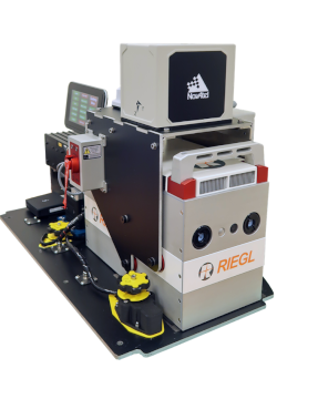
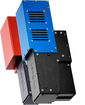
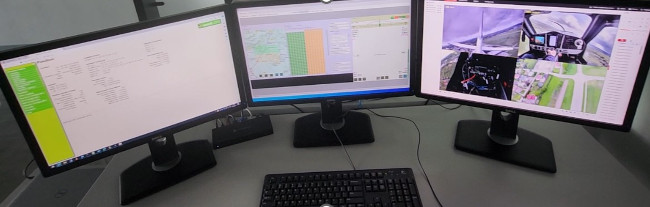
Technologies we use

Logo of the Phase One
Logo of the Riegl
Logo of the Novatel
Logo of the Trimble Applanix
Logo of the HySpex
Logo of the Vectornav
Logo of the Flir

Example usecases

The advantage of Alter-Eye compared to drones is high operability, resulting from the high take-off weight allowed by the regulations, which allowing the placeing off efficient devices and large fuel reserves on board - increasing the range and duration of air missions, even up to several hours.

2 cm GSD RGB NIR ortomosaic

This collection was conducted to recognize parasites in forest trees and assess their risk of extinction. The resolution achievable with Alter-Eye surpasses that of aircraft and reaches a level of precision previously attainable only with drones.

Its outstanding performance opens up new possibilities for industrial and large-scale applications in forested areas that are inaccessible to drones.

Performance
Alter-Eye 200 sq km in 5 hours (100%)
Drone 5 sq km in 5 hours (2.5%)

100 PT/M2 dense point cloud

The dense point cloud collected by Alter-Eye enables dendrometric measurements of every single tree in the forest stand. These individual tree models can replace the need for human labor during forest inventory, with one hour of flight equating to 8,000 hours of fieldwork. Alter-Eye offers capabilities that are inaccessible to other types of aircraft and delivers performance that surpasses that of drones.

Performance
Alter-Eye 160 sq km in 5 hours (100%)
Drone 2 sq km in 5 hours (1.25%)

Simultaneous measurements: ALS and RGB NIR

This collection, covering approximately 100 square kilometers of National Park, was achieved through simultaneous measurements in a single cross flight within 4 hours. It enables real 3D modeling of any detail within the park at various scales. Such measurements are inaccessible to drones and can only be obtained using a helicopter.

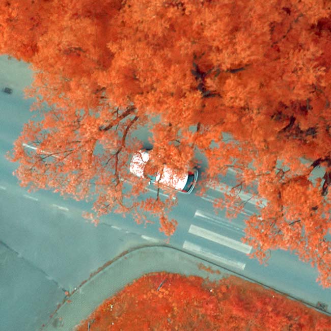
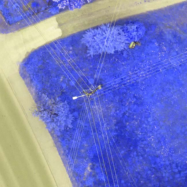
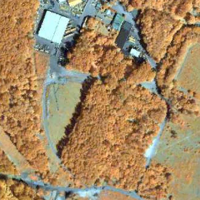
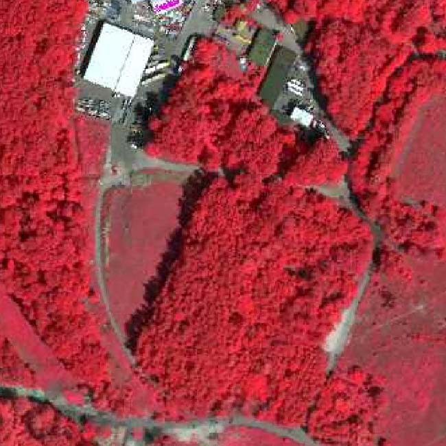
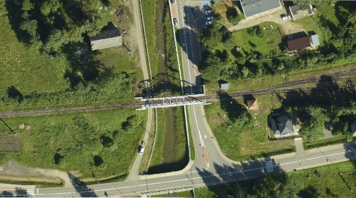
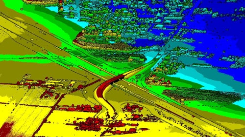
Infrastructure - corridor mapping

This ALS collection, featuring 30 points per square meter and 5 cm GSD in RGB and NIR, was conducted by Alter-Eye for corridor mapping of a mountain railway. It replaced traditional surveying during the reconstruction and modernization of railway tracks. Drones face significant challenges with such tasks due to the need for hundreds of mini-projects.

Urban Area Mapping

The cross section of classified points cloud collected by LIDAR scanner allowe full 3D building modeling.

AlterGeo is committed to using cutting-edge technology to fulfil commercial and special demands. Discover what we can contribute to your case.

Visit our laboratory
in Poland.

Satellite surveillance station
Before investing approximately $0.5 million in Alter-Eye, we recommend experiencing the technology firsthand. Visit our multisensory technology laboratory in the Carpathian region, at the heart of Europe. Collect your first demo data and observe the production process of Alter-Eye. Establish personal relationships with the team who will support you when challenges arise.
Alter-Eye plane at sunset
Discover the birthplace of the world's first petrochemical and petroleum company, established in 1854 by Ignacy Łukasiewicz, Karol Klobassa-Zrencki, and Tytus Trzecieski. Stay at the magnificent Hotel Palace Polanka, where the company had its first office. Enjoy a test flight over this beautiful and historic area.
Hotel Palace Polanka
Let's talk about solution for you

Standard delivery time - 6 months.

Delivery includes:

  • integrated aircraft with sensors;
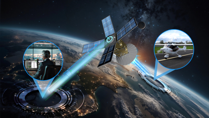
  • satellite connection subscription,
  • ground control station;
  • system configuration and training.